UK · Ground risk register · Built for crews

The groundremembers.

A shared map of buried hazards before the next digger arrives. Crews drop pins with photos when they find ducts, cables, mains, and unknown services the drawings missed.

Download the app
Compliant with
LSBUD
NUAR
HSG47

Solo tier free · Offline-first · v2.1 · Reading, UK

60,000

utility strikes a year in the UK.

Utility Strike Avoidance Group, USAG 2023 annual report. The number has barely moved in a decade.

Most sites already hold the information to avoid the next strike. Someone on the last phase spotted the unmarked fibre at 0.4 m. The drainage crew noticed the gas main ran two metres west of the drawing.

GroundPin is the place it gets written down — a pin, a photo, a utility colour, shared with your team and, where you choose, with the other contractors working the same road.

It doesn't replace a CAT scan, an LSBUD search, or an NUAR lookup. It stops good ground knowledge getting binned at the end of every phase.

§ 03 · Field log · last 24h

Pins from the ground.

1,247 pins synced today →

Illustrative only · Photos supplied to GroundPin for marketing use · Pin details are representative, not live data

§ 04 · In your pocket, on your site

Offline-first.
Signal optional.

Live on the App Store and Google Play. Free Solo tier, no card required.

Sites · Map view
GroundPin Android app showing a map of UK sites with orange pin markers
Pin detail · Risk log
GroundPin app showing a pin detail view with utility type, depth, GPS and field notes

Solo tier is permanently free — no card required. Drop pins and capture photos with no signal; sync runs when the app is open or active in the background so the queue drains as soon as the handset picks up 4G or wi-fi.

§ 02 · Procedure

Three taps, no admin.

Reads like the safe-system-of-work, because it is one. Replaces the WhatsApp message with a record.

01Find it.

Driver spots an unmapped asset. Opens GroundPin, taps the spot on a satellite tile that's already cached. Works without signal.

02Pin it.

Photo, depth, utility colour, voice note. Auto-stamps GPS, time, user, sheet ref. Three taps and fifteen seconds.

03Hand it over.

Pin syncs the moment they're back on data. The next crew sees it before their bucket goes near it.

GroundPin web dashboard showing the Farringdon Crossrail exit works site with an aerial view of the pin map

Site dashboard · every pin from every crew, on one view.

Product evidence

What a pin looks like on site

GPS fix, photo, utility, a short note

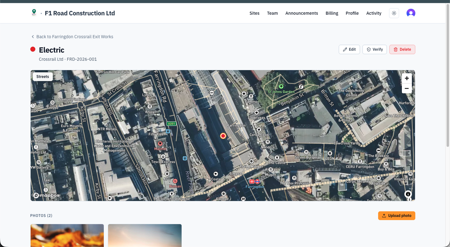
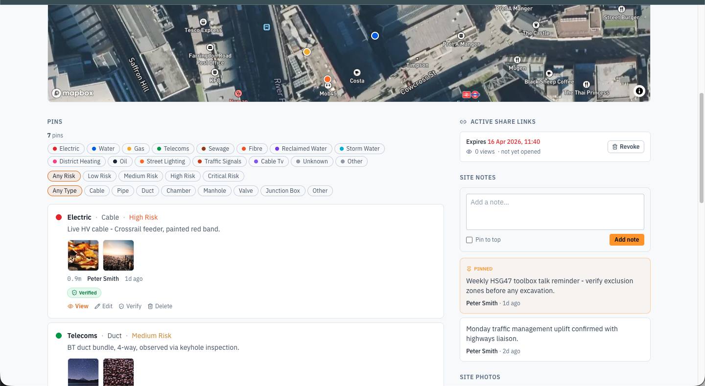
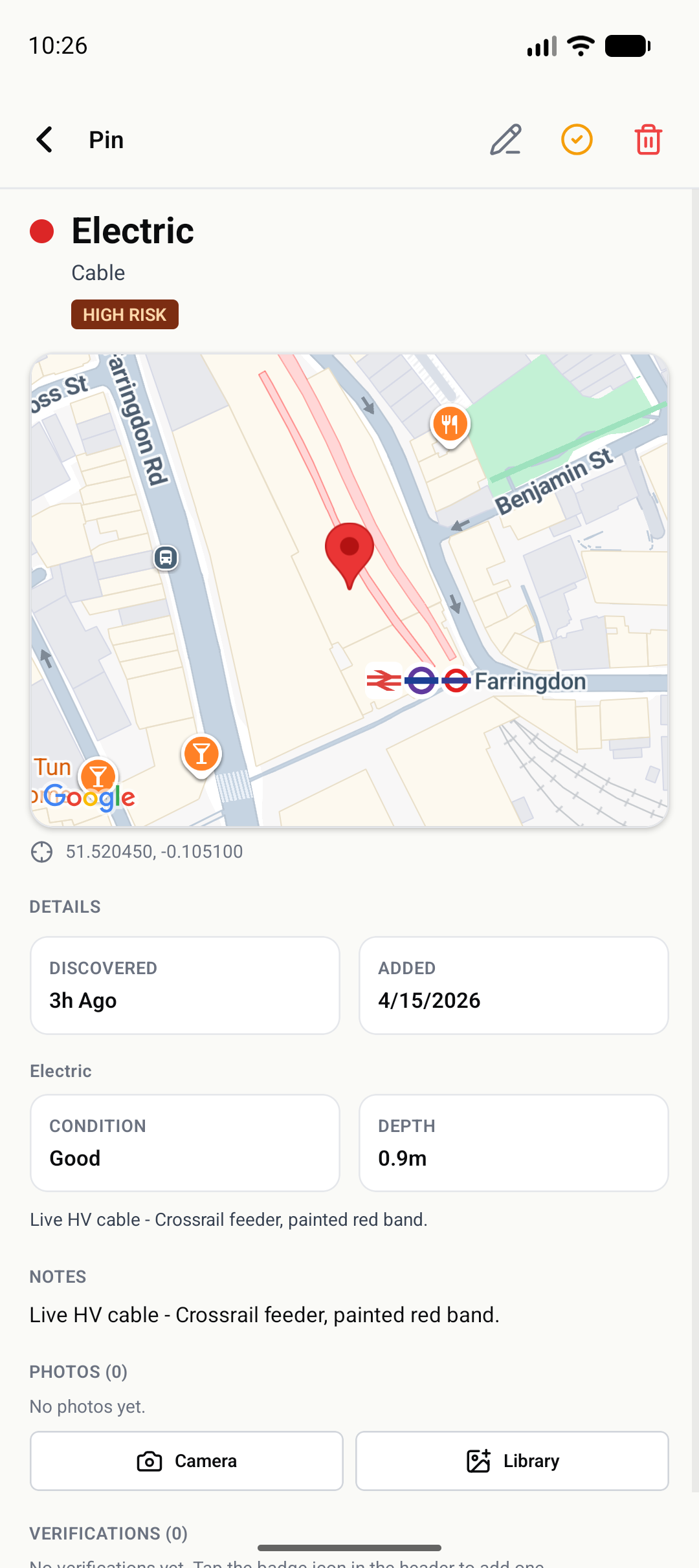
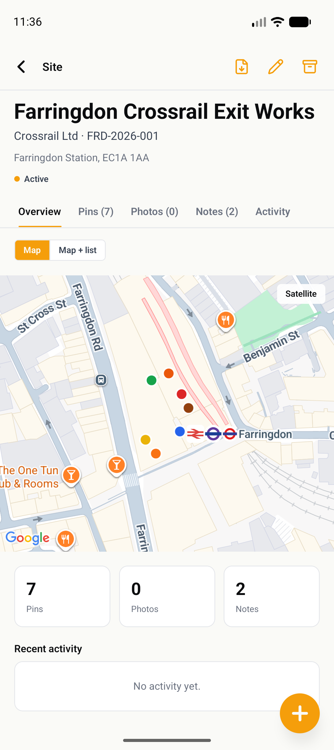
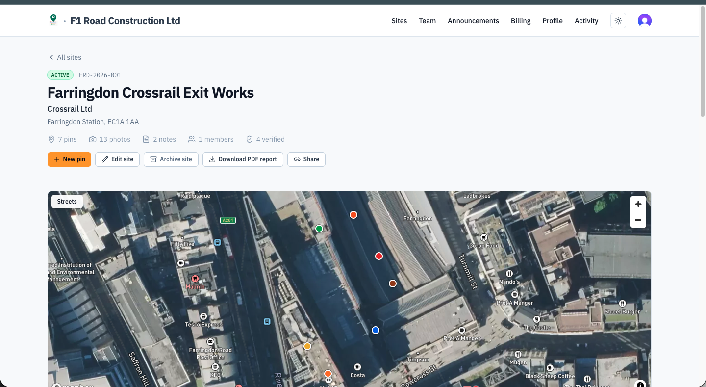
Every pin carries a GPS fix, on-site photos, a utility type, a risk rating and a note. GPS on a modern phone is good to 3–5 m in the open and worse next to tall buildings, so a pin says “there's a hazard in this area, look at the photo” — not “the cable is exactly here.”

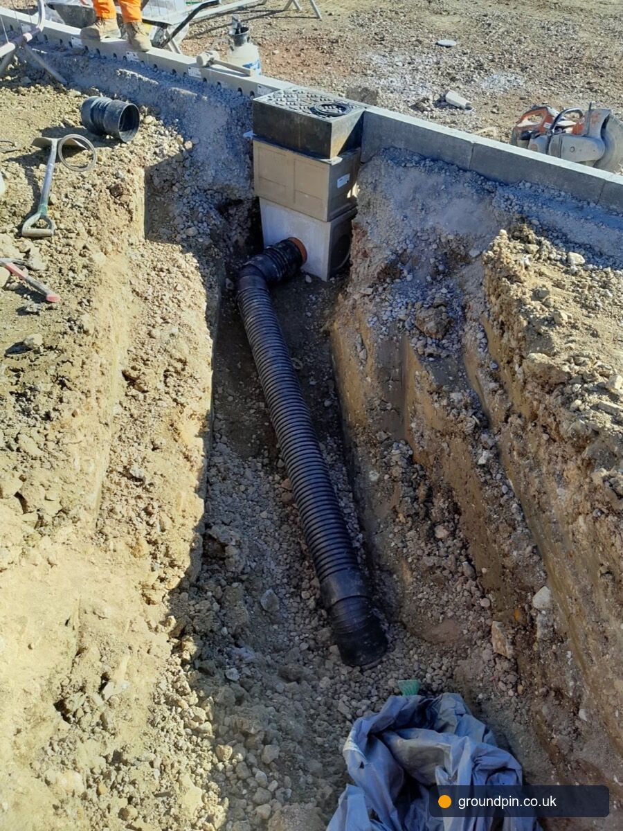
CAT scan and trial-hole before excavation still apply. The photo is what the crew actually digs by.

GroundPin pin detail view on the web dashboard, showing an electric cable pin in Farringdon with an aerial map and thumbnails
GroundPin site pins board showing pins grouped by utility with filters and notes

One site map, every crew on it

Phase 1 groundworkers, the M&E subbie, the site manager in the cabin, and the second-fix crew six months later all look at the same pins. Not a WhatsApp thread, not a photo library on one foreman's phone.

GroundPin activity feed showing recent pin verifications and uploaded evidence across the organisation

Audit trail by default

Every pin, edit, photo and verification is stamped with a named user and a time. If a CDM coordinator or a solicitor later asks who knew what and when, the trail is already there.

HSG47 colours, on the map

HSG47 is the HSE's guidance note on avoiding danger from underground services. Every CAT survey, utility drawing and mark-out team in the country already works to it. GroundPin pins use the same colours on the map, so there's no new legend to learn and a pin can be read at arm's length in poor light.

Fibre, street lighting, district heating, oil and reclaimed water are included. Read HSG47 at hse.gov.uk.

Utility colour reference

  • Electric
  • Water
  • Gas
  • Telecoms
  • Fibre
  • Sewage
  • Street lighting
  • Traffic signals
  • District heating

Offline-first, in a trench

Drop pins, capture photos, edit utility records and verify a colleague's work with no signal at all — every change is saved on the device and queued. Sync runs when the app is open or active in the background, so the queue drains without anyone touching it. No data entry backlog at the end of the day.

Your sites, your data

Pins belong to a site. A site belongs to your company. Subcontractors see only the sites you invite them to. Admins can pull a CSV or a PDF at any time; a full export is available on the Business plan.

Pricing

Per user, billed monthly, cancel any time. Unlimited pins and sites on every paid tier.

Solo

Solo contractors and sole traders trying the app.

Free

For one user. No card required.

  • Up to 25 pins
  • 1 site
  • 3 photos per pin
  • Android and iPhone
Start free

Team

Small groundworks firm or a single project crew.

£12.99/ user / month

Billed monthly. Minimum 2 users. Annual saves two months.

  • Unlimited pins and sites
  • 10 photos per pin
  • Offline-capable mobile app
  • Team sharing inside the org
  • From 2 seats

On the roadmap

  • CSV export
Start free trial

Pro

Multi-site contractors running handovers between phases.

£19.99/ user / month

Billed monthly. Minimum 5 users. Annual saves two months.

  • Everything in Team
  • 20 photos per pin
  • Web dashboard
  • PDF site reports
  • Photo annotation
  • Pin verification
  • Custom utility types
  • Share links (up to 5 active)
  • From 5 seats

On the roadmap

  • what3words
  • CSV export
Start free trial
Recommended

Business

Principal contractors and Tier-1 firms running supply chains.

£29.99/ user / month

Billed monthly. Minimum 10 users. Annual saves two months.

30-day free trial · cancel anytime

  • Everything in Pro
  • Unlimited photos per pin
  • Unlimited active share links
  • Share-link view log + audit
  • Priority support
  • From 10 seats

On the roadmap

  • Cross-company data sharing
  • Public API access
  • Heatmaps + density analytics
  • SSO (SAML / OIDC)
  • Audit log export
  • Custom branding on PDFs + share pages
Start free trial

Enterprise

Frameworks, utilities, and large portfolios.

Everything in Business · Bespoke contract terms · Custom agreements

Get in touch

Prices exclude VAT. 30-day free trial on Business. Subcontractors invited to a site do not consume a user on your plan.

Questions

If yours isn't here, email hello@groundpin.co.uk.

Does this replace LSBUD or NUAR?
No, and it isn't meant to. LSBUD, the NUAR beta, and your utility record drawings are the statutory starting point. GroundPin is what your team adds on top once they're on site and find something the drawings got wrong.
What if we're in a trench with no signal?
GroundPin is offline-first. Drop pins, capture photos, edit utility records and verify a colleague's work with no connection at all — every change is saved on the device. Sync runs when the app is open or active in the background, so the queue drains as soon as the handset picks up 4G or wi-fi. You don't need to be in the cabin to drop a pin.
Who can see the pins my team drops?
By default, your team. Pins live inside a site, and a site belongs to your company. You choose who joins. On the Business plan there's a separate option to share pin data across the other companies working the same road, with each company's admin opting in.
Is it accurate enough to dig by?
GPS on a modern phone is good to around 3 to 5 metres in the open and worse next to tall buildings. A pin tells a crew “there's a hazard in this area, look at the photo,” not “the cable is exactly here.” CAT scan and trial-hole before excavation still apply. The photo is what you actually dig by.
Can subcontractors use the app without paying?
Yes. You invite subbies to a site and they get view and pin-drop access for that site only. Your paid seats are for the staff running things.
Where is the data stored?
UK, on infrastructure hosted in London. We don't sell pin data, and on the Business plan you can pull a full export at any point. GroundPin is operated by D4N Ltd, an East Midlands-based company (no. 17061504).
GroundPin — underground hazard mapping for UK construction